-

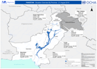
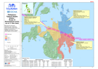
Pakistan Floods: Khyber Pakhlunkhwa Province - Flood Impact Profile (fromthe ...
This map shows a summary of the situation in the Khyber Pakhtunkhwa Province as taken from the Government of Khyber Pakhtunkhwa Provincial Disaster Management Authority... -
Pakistan - Situation Overview by Province - 21 August 2010
Map shows data of deaths, affected population, and damaged houses provided by the Provincial and National Disaster Management Authorities. (PDMA and NDMA). This information has... -
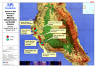
Overview with Flood Affected Tehsils - Khyber Pakhtunkhwa
This map shows the flood affected areas in the Khyber Pakhtunkhwa Province. -

-

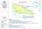
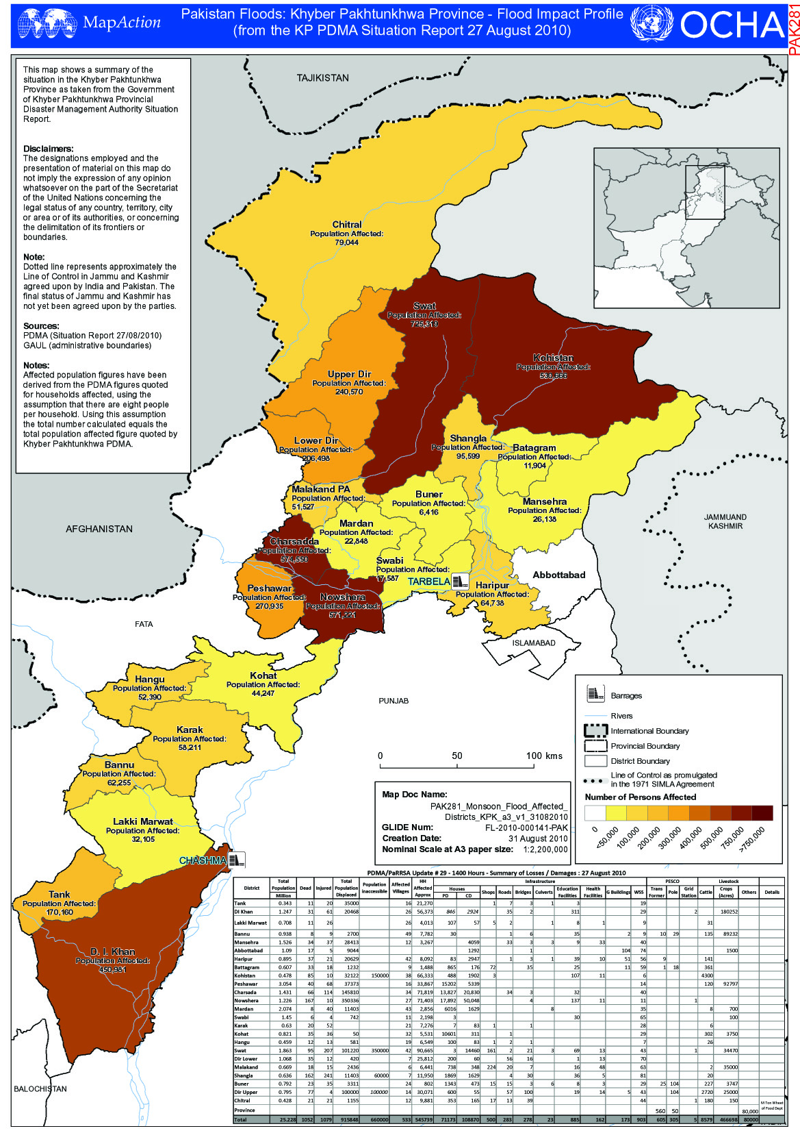
Union of the Comoros Floods Moheli - Villages with reported problems
Map showing reported problems in villages on Island of Moheli, Comoros. -
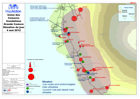
Union des Comores Inondations Grande Comore Situation du jour 4 mai 2012
Map showing flood affected population and status of affected transport infrastructure, as of 4 May 2012. [In French] -
Union des Comores Inondations Moheli Situation du jour 4 mai 2012
Situation map for Moheli as of 4 May 2012. [In French] -

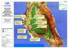
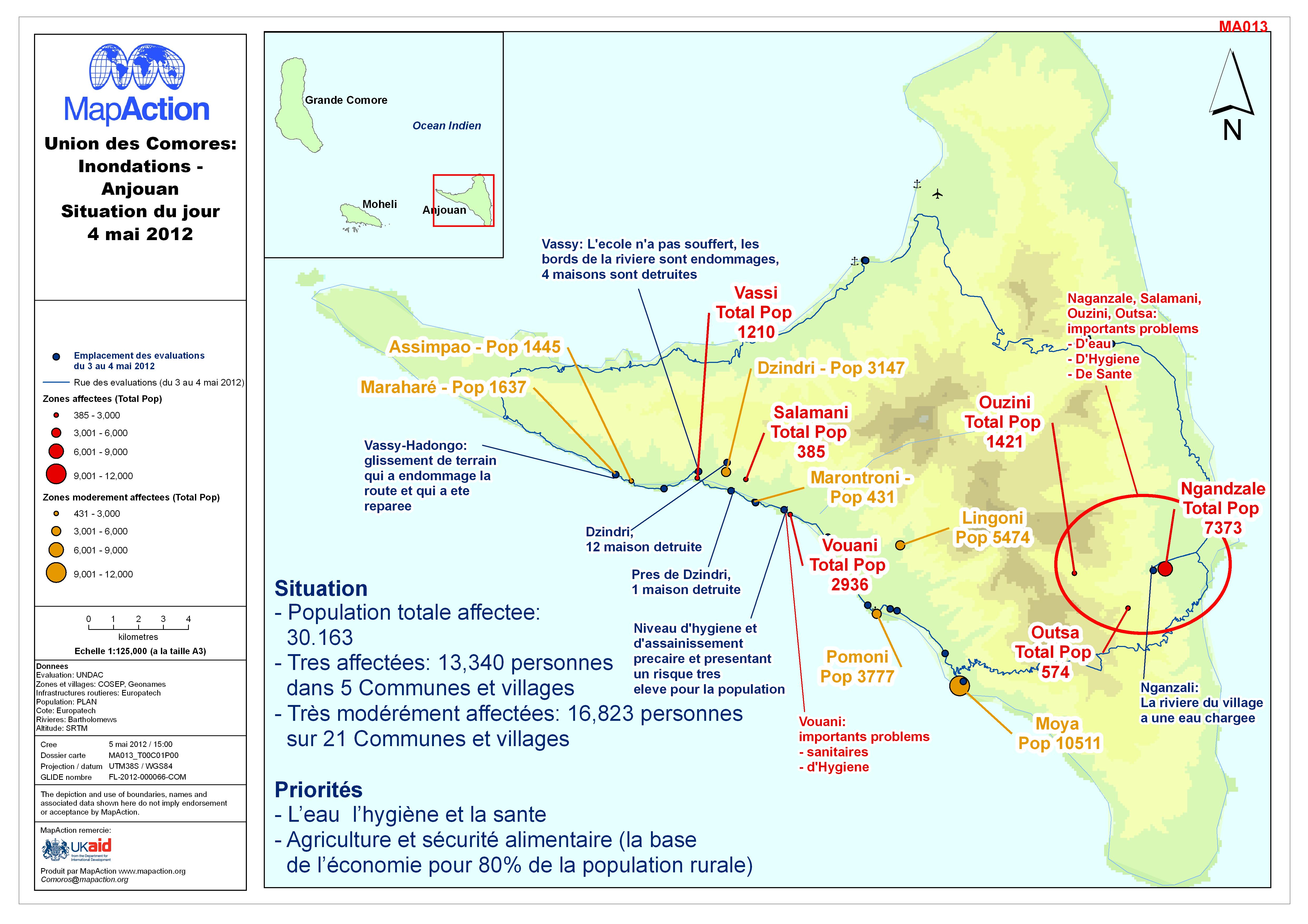
Union des Comores: Inondations - Anjouan Situation du jour 4 mai 2012
Situation map of Anjouan as of 4 May 2012. [In French] -
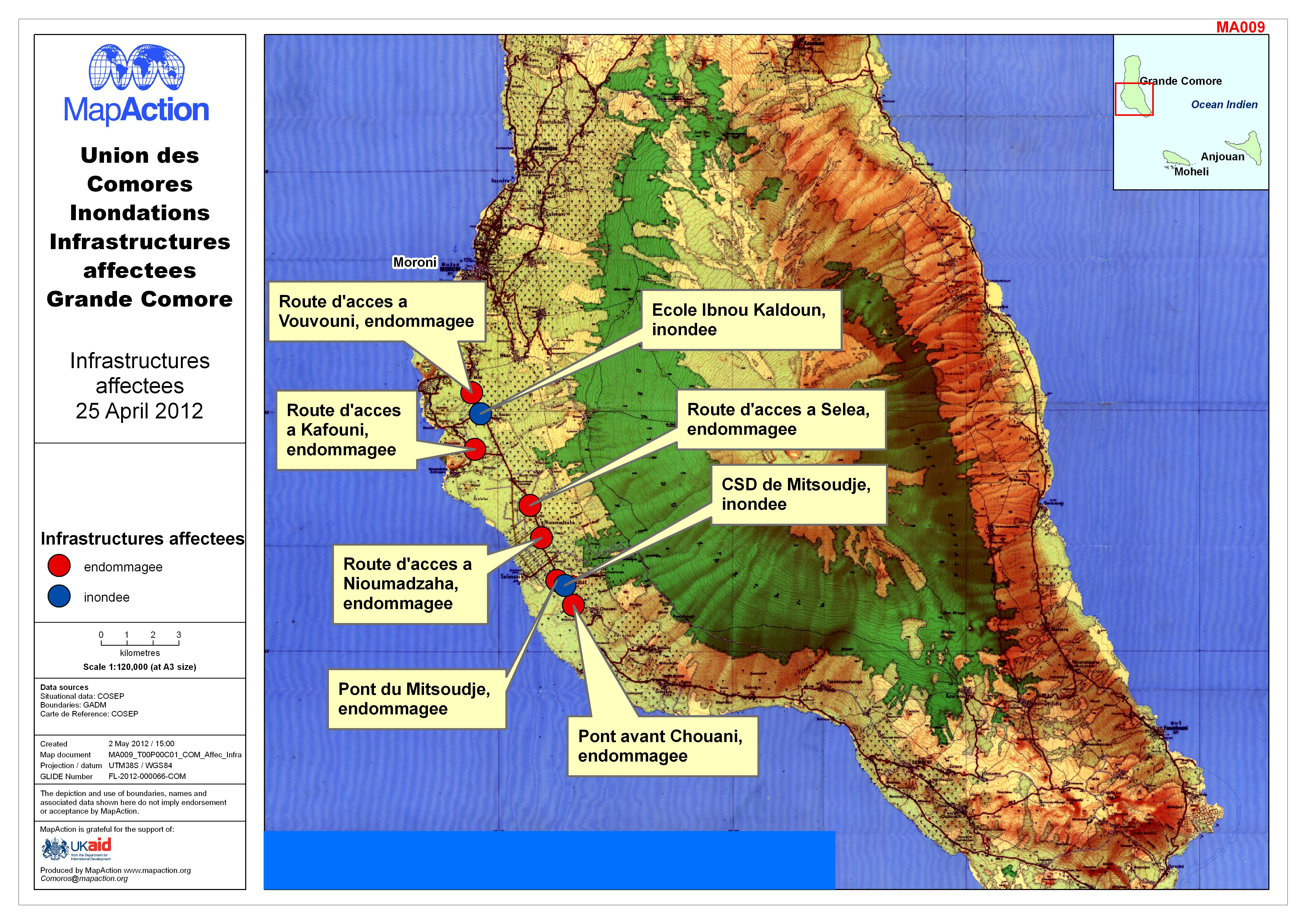
Union des Comores Inondations Infrastructures affectees Grande Comore
Map shows damaged infrastructure on Grande Comore. [In French]. -
Union of the Comoros: Floods - Affected Infrastructure on Grande Comore
Affected Infrastructure as of 25 April 2012 -
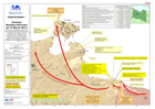
Libya: Complex - (Tunisia) Situation Overview (at 13 March 2011)
Map shows humanitarian operations in the Tunisian/Libyan border region being conducted as of 13 March, and any reported security incidents in the previous 24 hours. Locations... -

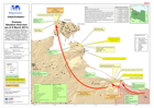
Libya: Complex - (Tunisia) Situation Overview (at 12 March 2011)
Map shows humanitarian operations in the Tunisian/Libyan border region being conducted as of 12 March, and any reported security incidents in the previous 24 hours. Locations... -

Libya: Complex - (Tunisia) Situation Overview (at 11 March 2011)
Map shows humanitarian operations in the Tunisian/Libyan border region being conducted as of 11 March, and where known, which humanitarian agencies are operating at these... -

-
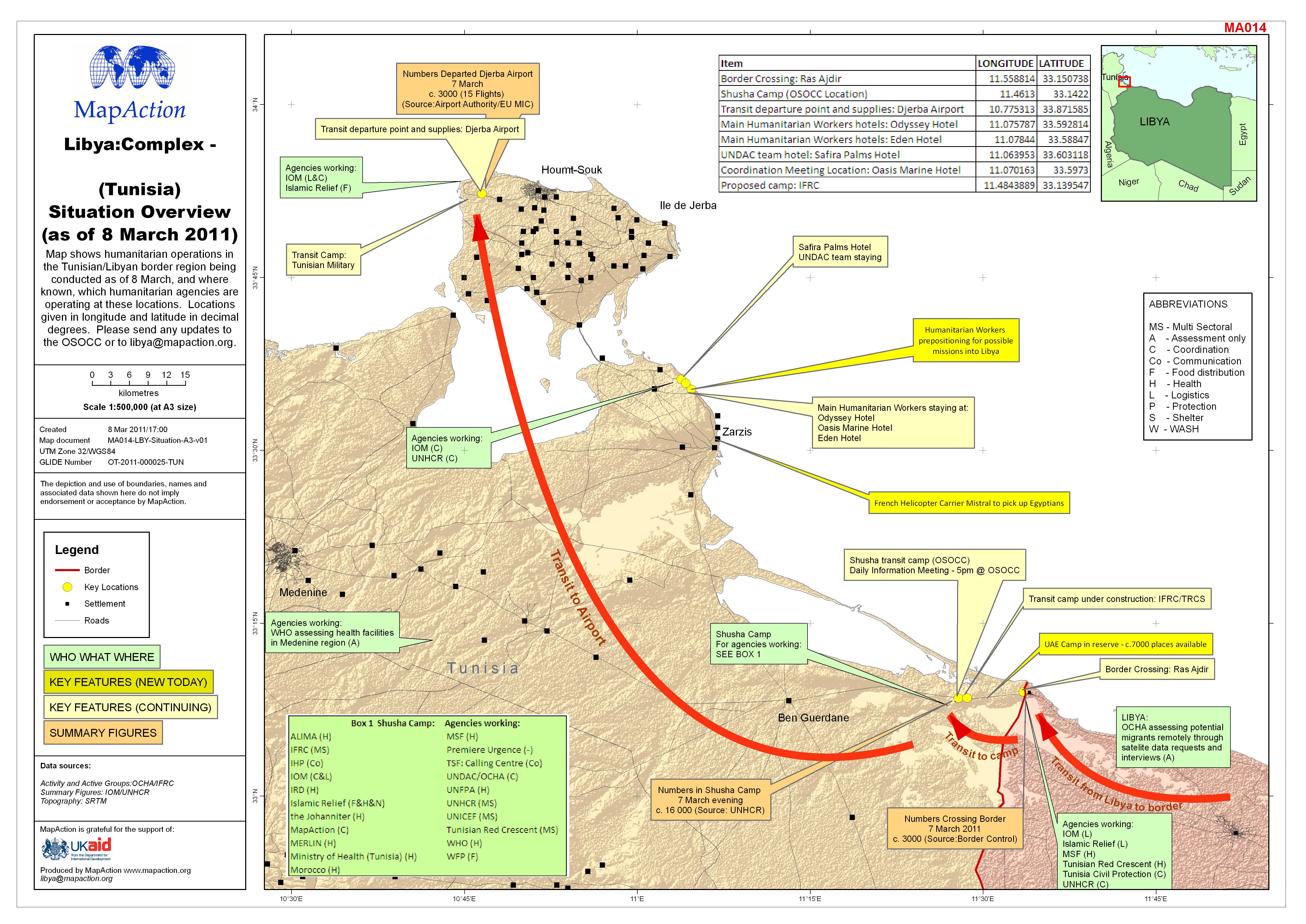
Libya: Complex - (Tunisia) Situation Overview (as of 8 March 2011)
This dataset has no description
-

Libya: Complex - (Tunisia) Situation Overview (as of 7 March 2011)
This dataset has no description
-
Philippines Typhoon Bopha (Pablo) - Status of Lifelines (as of 12 Dec 2012)
Map shows disruption to Power, Water and Communications by Municipality and restricted road access in Regions 11 and 13. Based on NDRRMC "Sit Rep 25 Re effects of Typhoon Pablo... -

Philippines: Typhoon Bopha (Pablo) - Scope of Humanitarian Crisis (as at 12 D...
Map shows the scope of the humanitarian crisis. Numbers for affected population, deaths,injuries, missing, Pop in Evacuation Centres, and damage to housing. Source is "NDRRMC... -
Philippines: Typhoon Bopha (Pablo) - Scope of Humanitarian Crisis (as at 11 D...
Map shows the scope of the humanitarian crisis. Numbers for affected population, deaths,injuries, missing, Pop in Evacuation Centres, and damage to housing. Source is "NDRRMC... -

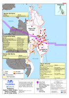
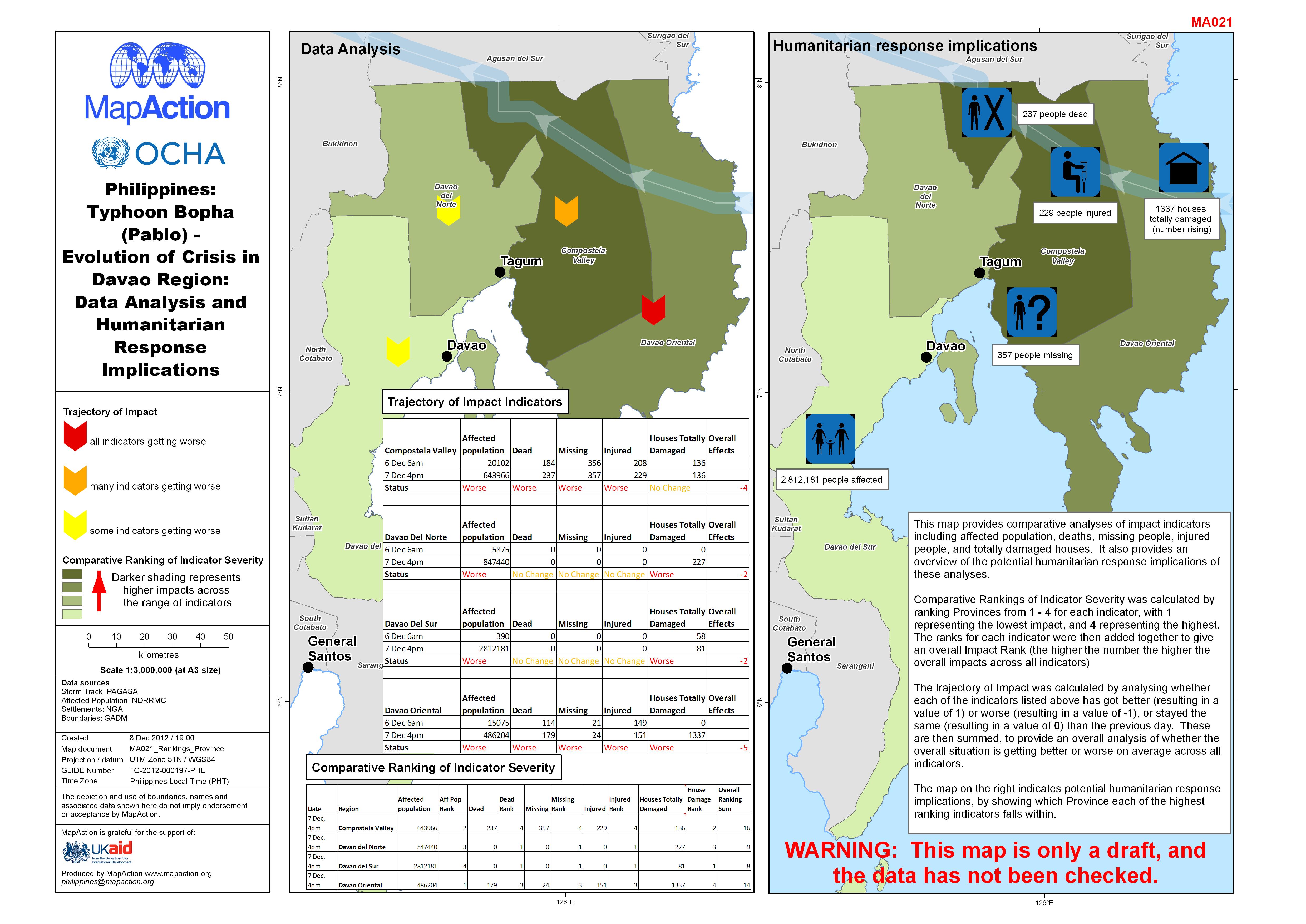
Philippines: Typhoon Bopha (Pablo) - Evolution of Crisis in Davao Region: Dat...
This map provides comparative analyses of impact indicators including affected population, deaths, missing people, injured people, and totally damaged houses. It also provides...